AERIAL MAPPING AND SURVEYING
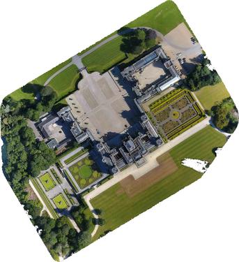
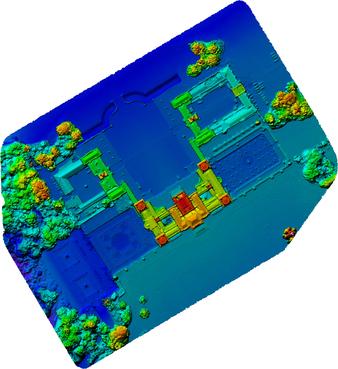
Vertech Imaging has a range of fixed and rotary wing drones suitable for a range of technical tasks in the field of Geomatics, and can achieve accuracies not possible with manned aircraft or conventional ground-based methods. Combined with state-of-the-art photogrammetry software, we can produce the following geo-datasets:
- Point clouds
- Ortho-rectified maps/orthomosaics
- DEM (Digital Elevation Models)
- DSM (Digital Surface Models)
- 3D Models
Typical applications include:
- Topgraphical surveys
- BIM (Building Information Modeling)
- 3D visualization
- Aerial virtual tours
- Determination of land boundaries
- Coastal erosion monitoring
- Flood risk management
- Quarry/mining management
- Stockpile measurement
- Heritage recording


